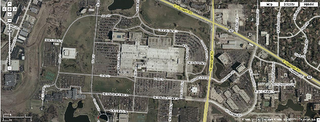
 ping between the map coordinates to screen coordinates.
Take some advantage of Google Map will be an quick and easy way, as the URL is encoded with longitude and latitude values. One of the maps I used has a URL like this: ll=42.065957,-88.048339&spn=0.007678,0.027122
"spn" is for "span", which is easy to guess. By my guess that "ll" stands for "Lower Left" is wrong. It is actually the center of the map. Tricky! So, the decoded format of the URL is:
ll=latitude_of_map_center, longitude_of_map_center & spn= total_latitude_span, total_longitude_span.
